Ragiv:Tours Saint-Jacques - 195.jpg

Ragiv rigik(4,582 × 3,055 pixel, ragivagret: 13.44 MB, pated MIME: image/jpeg)

Ragiv at kömon de Wikimedia Commons e kanon pagebön fa proyegs votik. Bepenot su pad bepenota ragiva onik pajonon dono.

Plän brefik

Bepenam
If you can, help make this description accessible to all by translating it into other languages. – Thanks!
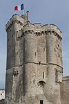
English: Hotel Restaurant Aux Gorges du Chéran and west view of the Saint-Jacques Towers on the Semnoz in the background, from the pont de l'Abîme in Cusy, France.
Español: Vista del hotel restaurante Aux Gorges du Chéran y, en el fondo, las torres de Saint-Jacques en el macizo del Semnoz. Foto tomada desde pont de l'Abîme en Cusy, Alta Saboya, Francia.
Français : Hôtel Restaurant Aux Gorges du Chéran et vue ouest des tours Saint-Jacques sur le Semnoz en arrière-plan, depuis le pont de l'Abîme à Cusy, France.
Polski: Widok z mostu l'Abîme (pont de l'Abîme) w Cusy na hotel i restaurację Aux Gorges du Chéran oraz, w tle, zachodnią stronę wież św. Jakuba (tours Saint-Jacques) na górze Semnoz we Francji.
Português: Vista do hotel restaurante Aux Gorges du Chéran e ao fundo, as torres de Saint-Jacques no maciço de Semnoz. Foto tirada do pont de l'Abîme em Cusy, Alta Saboia, França.
Українська: Готель-ресторан О’Жорж дю Шера Aux Gorges du Chéran і вид на башти Сен-Жак на фоні гори Semnoz з мосту Безодні (pont de l'Abîme) в Кюзі, Франція.
Čeština: Hotel a restaurant Aux Gorges du Chéran a pohled na skalní útvat Saint-Jacques Towers na hoře Semnoz v pozadí, snímek z mostu Pont de l'Abîme v osadě Cusy, Francie.
Magyar: Az Aux Gorges du Chéran fogadó, háttérben Saint-Jacques-tornyok sziklával (Cusy, Franciaország)
Italiano: L'Hotel ristorante Aux Gorges du Chéran sul monte di Semnoz in Alta Savoia. Sullo sfondo le torri di Saint-Jacques.
Македонски: Хотелот и ресторан О Жорж ди Шеран и природните кули Сен Жак во Семноз кај Кизи, Франција.
Nederlands: Hotel-restaurant Aux Gorges du Chéran en uitzicht op de Tours Saint-Jacques op de Semnoz in het Franse departement Haute-Savoie.
Dät
Fon Vobot okik
Lautan
Another one of my pictures:


This photograph was taken by Medium69 (William Crochot) and released under the license stated below. You are free to use it for any purpose as long as you credit the author (William Crochot), the Source (Wikimedia Commons) and the license (CC-BY-SA 4.0) in close relation to the image.

This file has been released under a license which is incompatible with Facebook's licensing terms. It is not permitted to upload this file to Facebook.

Please do not upload an updated image here without consultation with the Author. The author would like to make corrections only at his own source RAW. This ensures that the changes are preserved.
Please if you think that any changes should be required, please inform the author.
Otherwise you can upload a new image with a new name. Please use one of the templates derivative or extract.


Attribution
(required by the license)
InfoField
© William Crochot / Wikimedia Commons / 
© William Crochot / Wikimedia Commons
Assessments
InfoField
Featured image
Quality magod
Quality magod

Wikimedia Commons

This is a featured picture on Wikimedia Commons (Featured pictures) and is considered one of the finest images. See its nomination here.
This is a Quality image and is considered to meet the Quality image guidelines.

If you have an image of similar quality that can be published under a suitable copyright license, be sure to upload it, tag it, and nominate it.

Camera location45° 45′ 51.95″ N, 6° 03′ 24.61″ E  Heading=106° Kartographer map based on OpenStreetMap.View this and other nearby images on: OpenStreetMapinfo

Dälastad

I, the copyright holder of this work, hereby publish it under the following license:
w:en:Creative Commons
attribution share alike
This file is licensed under the Creative Commons Attribution-Share Alike 4.0 International license.
Binol libik:
  • to share – to copy, distribute and transmit the work
  • to remix – to adapt the work
Under the following conditions:
  • attribution – You must give appropriate credit, provide a link to the license, and indicate if changes were made. You may do so in any reasonable manner, but not in any way that suggests the licensor endorses you or your use.
  • share alike – If you remix, transform, or build upon the material, you must distribute your contributions under the same or compatible license as the original.

Captions

Add a one-line explanation of what this file represents

Items portrayed in this file

depicts Linglänapük

some value

copyright status Linglänapük

copyrighted Linglänapük

inception Linglänapük

13 yulul 2015

45°45'51.948"N, 6°3'24.606"E

heading Linglänapük: 106 degree

captured with Linglänapük

Canon EOS 6D Linglänapük

source of file Linglänapük

Jenotem ragiva

Välolös däti/timi ad logön ragivi soäsä äbinon ün tim at.

Dät/TimMagodilMafotsGebanKüpet
anuik01:20, 2015 dekul 20idMagodil fomama tü 01:20, 2015 dekul 20id4,582 × 3,055 (13.44 MB)Medium69Ajustement
17:26, 2015 tobul 25idMagodil fomama tü 17:26, 2015 tobul 25id4,743 × 3,162 (14.18 MB)Medium69Recadrage et correction
12:16, 2015 tobul 11idMagodil fomama tü 12:16, 2015 tobul 11id5,273 × 3,515 (15.09 MB)Medium69Correction
00:37, 2015 tobul 6idMagodil fomama tü 00:37, 2015 tobul 6id5,273 × 3,515 (13.14 MB)Medium69Redressement photo
20:58, 2015 setul 9idMagodil fomama tü 20:58, 2015 setul 9id5,394 × 3,596 (13.6 MB)Medium69User created page with UploadWizard

Pads sököl payümons ko pad at:

Ragivigeb Valöpik

The following other wikis use this file:

Ragivanüns