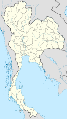
Ragiv:Thailand location map.svg

Size of this PNG preview of this SVG file: 341 × 600 pixels. Other resolutions: 136 × 240 pixels • 273 × 480 pixels • 436 × 768 pixels • 582 × 1,024 pixels • 1,164 × 2,048 pixels • 1,051 × 1,849 pixels.
Ragiv rigik (ragiv in fomät: SVG, magodaziöbs 1,051 × 1,849, gretot: 662 KB)
Plän brefik
| Bepenam |
Deutsch: Positionskarte von Thailand
Quadratische Plattkarte, N-S-Streckung 103 %. Geographische Begrenzung der Karte:
English: Location map of Thailand
Equirectangular projection, N/S stretching 103 %. Geographic limits of the map:
|
| Dät | |
| Fon |
Vobot okik, using
|
| Lautan | NordNordWest |

|
This map has been made or improved in the German Kartenwerkstatt (Map Lab). You can propose maps to improve as well.
|
Dälastad
I, the copyright holder of this work, hereby publish it under the following licenses:

|
Däl pagevon ad kopiedön, seagivön e/u votükön dokümi at ma Dälazöt ad Dokümam Libik: GNU, Fomam: 1.2 u nulikum fa el Free Software Foundation (Stitod: Nünömaprograms libik); nen diläds nevotükovik, nen vödems tegapada balid, e leigo nen vödems tegapada lätik. Kopied dälazöta pekeninon in diläd: Dälazöt ad Dokümam Libik: GNU panemöl. |
This file is licensed under the Creative Commons Attribution 3.0 Unported license.
- Binol libik:
- to share – to copy, distribute and transmit the work
- to remix – to adapt the work
- Under the following conditions:
- attribution – You must give appropriate credit, provide a link to the license, and indicate if changes were made. You may do so in any reasonable manner, but not in any way that suggests the licensor endorses you or your use.
You may select the license of your choice.
Jenotem ragiva
Välolös däti/timi ad logön ragivi soäsä äbinon ün tim at.
| Dät/Tim | Magodil | Mafots | Geban | Küpet | |
|---|---|---|---|---|---|
| anuik | 13:05, 2011 mäzul 22id | | 1,051 × 1,849 (662 KB) | NordNordWest | update, new province |
| 18:00, 2009 prilul 14id |  | 1,052 × 1,849 (1.04 MB) | NordNordWest | corr | |
| 19:57, 2009 mäzul 29id |  | 1,053 × 1,852 (924 KB) | NordNordWest | corr | |
| 18:03, 2009 mäzul 29id |  | 1,053 × 1,852 (924 KB) | NordNordWest | corr | |
| 19:08, 2009 mäzul 28id |  | 1,053 × 1,852 (925 KB) | NordNordWest | {{Information |Description= {{de|Positionskarte von Thailand}} Quadratische Plattkarte, N-S-Streckung 103 %. Geographische Begrenzung der Karte: * N: 20.6° N * S: 5.4° N * W: 97.1° O * O: 106.0° O {{en|Location map of [[:en:Thailand|T |
Yüms
Pads nonik peyümons ad ragiv at.
Ragivigeb Valöpik
The following other wikis use this file:
- Geb su af.wikipedia.org
- Geb su als.wikipedia.org
- Geb su an.wikipedia.org
- Geb su ar.wikipedia.org
- Geb su ast.wikipedia.org
- Geb su az.wikipedia.org
- Geb su ba.wikipedia.org
- Geb su be-tarask.wikipedia.org
- Geb su be.wikipedia.org
View more global usage of this file.