Ragiv:Smith County Texas Incorporated Areas Tyler highlighted.svg

Size of this PNG preview of this SVG file: 799 × 387 pixels. Other resolutions: 320 × 155 pixels • 640 × 310 pixels • 1,024 × 496 pixels • 1,280 × 620 pixels • 2,560 × 1,240 pixels • 1,055 × 511 pixels.
Ragiv rigik (ragiv in fomät: SVG, magodaziöbs 1,055 × 511, gretot: 587 KB)
Plän brefik
| Bepenam |
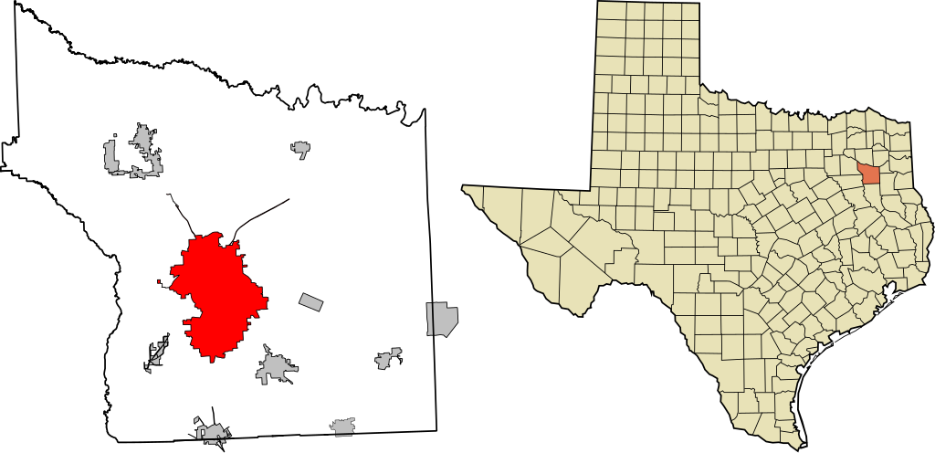
English: This map shows the incorporated areas in Smith County, Texas. Tyler is highlighted in red. I created it using GIS data from the City of Tyler. |
| Dät | |
| Fon | Vobot okik |
| Lautan | Jrduke |
Public Domain
Dälastad
| I, the copyright holder of this work, release this work into the public domain. This applies worldwide. In some countries this may not be legally possible; if so: I grant anyone the right to use this work for any purpose, without any conditions, unless such conditions are required by law. |
Jenotem ragiva
Välolös däti/timi ad logön ragivi soäsä äbinon ün tim at.
| Dät/Tim | Magodil | Mafots | Geban | Küpet | |
|---|---|---|---|---|---|
| anuik | 17:10, 2010 setul 28id | | 1,055 × 511 (587 KB) | Jrduke~commonswiki | {{Information |Description={{en|1=This map shows the incorporated areas in Smith County, Texas. Tyler is highlighted in red. I created it using GIS data from the [http://www.smithcountymapsite.org/webshare/data.htm Ci |
Yüms
Pads sököl payümons ko pad at:
Ragivigeb Valöpik
The following other wikis use this file:
- Geb su ar.wikipedia.org
- Geb su arz.wikipedia.org
- Geb su ca.wikipedia.org
- Geb su ceb.wikipedia.org
- Geb su cy.wikipedia.org
- Geb su en.wikipedia.org
- Geb su eo.wikipedia.org
- Geb su eu.wikipedia.org
- Geb su fa.wikipedia.org
- Geb su fi.wikipedia.org
- Geb su fr.wikipedia.org
- Geb su ga.wikipedia.org
- Geb su ht.wikipedia.org
- Geb su hu.wikipedia.org
- Geb su it.wikipedia.org
- Geb su ja.wikipedia.org
- Geb su no.wikipedia.org
- Geb su pnb.wikipedia.org
- Geb su ro.wikipedia.org
- Geb su simple.wikipedia.org
- Geb su sr.wikipedia.org
- Geb su tl.wikipedia.org
- Geb su tr.wikipedia.org
- Geb su tt.wikipedia.org
- Geb su ur.wikipedia.org
- Geb su www.wikidata.org
- Geb su zh-min-nan.wikipedia.org