Ragiv:Monrovia CA San Gabriel Mountains i210.JPG
Size of this preview: 800 × 600 pixels. Other resolutions: 320 × 240 pixels • 640 × 480 pixels • 1,024 × 768 pixels • 1,280 × 960 pixels • 1,920 × 1,440 pixels.
Ragiv rigik (1,920 × 1,440 pixel, ragivagret: 917 KB, pated MIME: image/jpeg)
Plän brefik
| Bepenam |
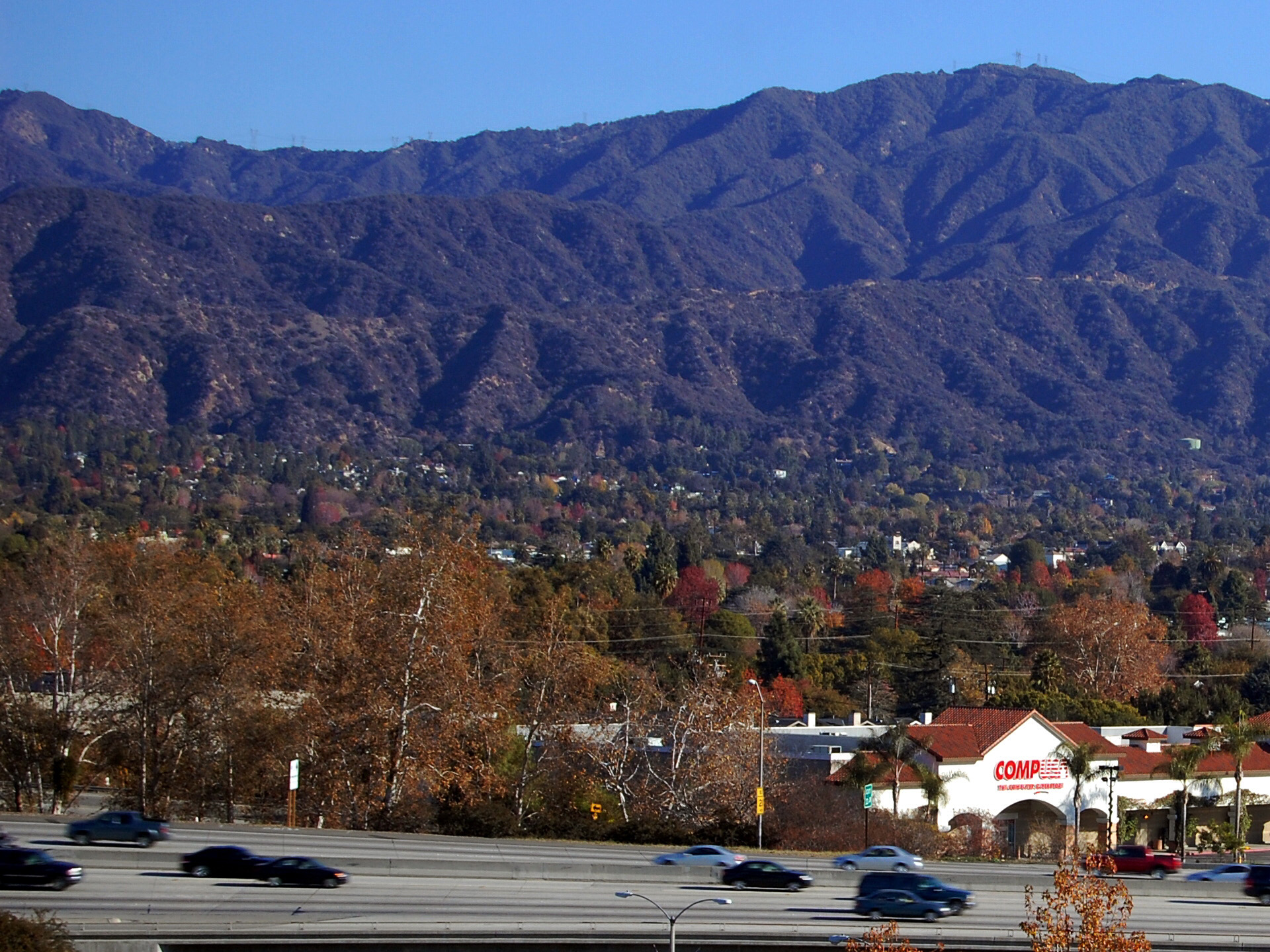
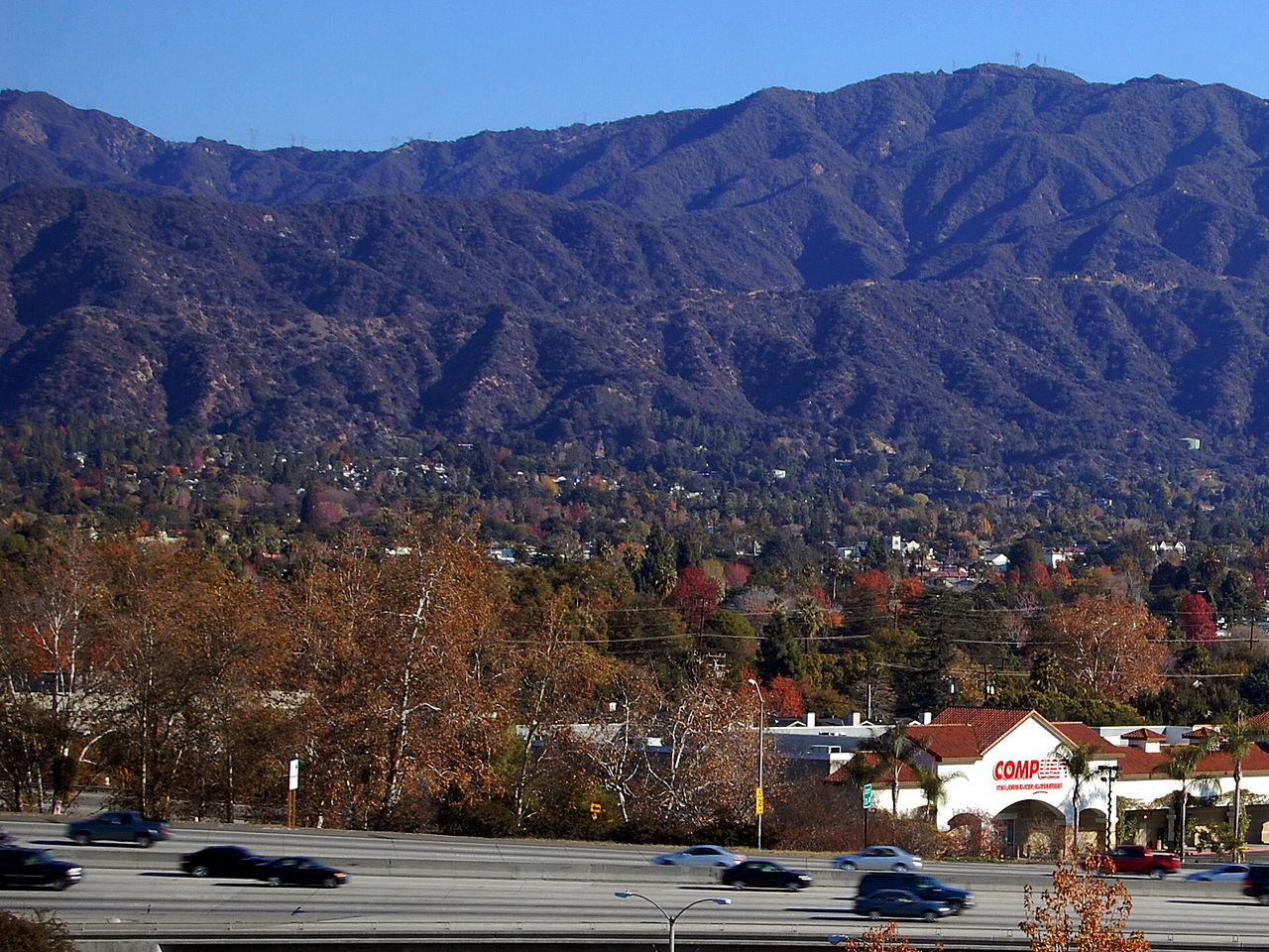
English: Interstate 210 in Monrovia, California with San Gabriel Mountains. Summit in upper right is Mount Bliss, (approx. 3240 feet AMSL). This summit is in the San Gabriel Mountains inside Angeles National Forest. |
| Dät | |
| Fon | Vobot okik (Original text: self-made) |
| Lautan | David Jordan |
Dälastad
This file is licensed under the Creative Commons Attribution-Share Alike 3.0 Unported license.
- Binol libik:
- to share – to copy, distribute and transmit the work
- to remix – to adapt the work
- Under the following conditions:
- attribution – You must give appropriate credit, provide a link to the license, and indicate if changes were made. You may do so in any reasonable manner, but not in any way that suggests the licensor endorses you or your use.
- share alike – If you remix, transform, or build upon the material, you must distribute your contributions under the same or compatible license as the original.
Original upload log
The original description page was here. All following user names refer to en.wikipedia.
- 2008-01-19 21:35 David Jordan 1920×1440× (939455 bytes) {{Information |Description=Interstate 210 in Monrovia, California with San Gabriel Mountains. |Source=self-made |Date=about 12/30/2007 |Location=Monrovia, CA, USA |Author=David Jordan |Permission= |other_versions= }}
Jenotem ragiva
Välolös däti/timi ad logön ragivi soäsä äbinon ün tim at.
| Dät/Tim | Magodil | Mafots | Geban | Küpet | |
|---|---|---|---|---|---|
| anuik | 04:16, 2009 setul 22id | | 1,920 × 1,440 (917 KB) | Optigan13 | {{Information |Description={{en|Interstate 210 in Monrovia, California with San Gabriel Mountains. Summit in upper right is Mount Bliss, (approx. 3240 feet AMSL). This summit is in the en:San Gabriel Mountains inside en:Angeles National Forest |
Yüms
Pads sököl payümons ko pad at:
Ragivigeb Valöpik
The following other wikis use this file:
- Geb su ar.wikipedia.org
- Geb su arz.wikipedia.org
- Geb su azb.wikipedia.org
- Geb su be.wikipedia.org
- Geb su bg.wikipedia.org
- Geb su ca.wikipedia.org
- Geb su ceb.wikipedia.org
- Geb su ce.wikipedia.org
- Geb su de.wikipedia.org
- Geb su en.wikipedia.org
- Geb su en.wikivoyage.org
- Geb su eo.wikipedia.org
- Geb su es.wikipedia.org
- Geb su eu.wikipedia.org
- Geb su fa.wikipedia.org
- Geb su fr.wikipedia.org
- Geb su he.wikivoyage.org
- Geb su ht.wikipedia.org
- Geb su hu.wikipedia.org
- Geb su it.wikipedia.org
- Geb su ja.wikipedia.org
- Geb su lld.wikipedia.org
- Geb su nl.wikipedia.org
- Geb su no.wikipedia.org
- Geb su pl.wikipedia.org
- Geb su pt.wikipedia.org
- Geb su ru.wikipedia.org
- Geb su rw.wikipedia.org
- Geb su simple.wikipedia.org
- Geb su sr.wikipedia.org
- Geb su sv.wikipedia.org
- Geb su sw.wikipedia.org
- Geb su tr.wikipedia.org
- Geb su tt.wikipedia.org
- Geb su uk.wikipedia.org
- Geb su ur.wikipedia.org
- Geb su uz.wikipedia.org
- Geb su www.wikidata.org
- Geb su zh-min-nan.wikipedia.org