Ragiv:Map Vianden.PNG
Gretot gudikum no pagebidon.
Map_Vianden.PNG (203 × 270 pixel, ragivagret: 6 KB, pated MIME: image/png)
Plän brefik
| Bepenam |
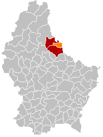
English: Own edit of Kanton ViandenLocatie.png |
| Dät | 18 tobul 2005 (original upload date) |
| Fon | No machine-readable source provided. Own work assumed (based on copyright claims). |
| Lautan | No machine-readable author provided. Markussep assumed (based on copyright claims). |
Dälastad
| I, the copyright holder of this work, release this work into the public domain. This applies worldwide. In some countries this may not be legally possible; if so: I grant anyone the right to use this work for any purpose, without any conditions, unless such conditions are required by law. |
Jenotem ragiva
Välolös däti/timi ad logön ragivi soäsä äbinon ün tim at.
| Dät/Tim | Magodil | Mafots | Geban | Küpet | |
|---|---|---|---|---|---|
| anuik | 17:55, 2018 yanul 8id | | 203 × 270 (6 KB) | NordNordWest | upd |
| 21:25, 2015 novul 10id |  | 203 × 270 (5 KB) | NordNordWest | no more districts in Luxembourg | |
| 21:18, 2011 tobul 28id |  | 203 × 270 (3 KB) | Les Meloures | replace map after creation of new municipalities | |
| 18:08, 2006 mayul 3id |  | 203 × 270 (4 KB) | Markussep | Tandel added | |
| 19:05, 2005 tobul 18id |  | 203 × 270 (4 KB) | Markussep | own edit of Image:Kanton ViandenLocatie.png Category:Maps of municipalities of Luxembourg |
Yüms
Pads sököl payümons ko pad at:
Ragivigeb Valöpik
The following other wikis use this file:
- Geb su als.wikipedia.org
- Geb su be-tarask.wikipedia.org
- Geb su ca.wikipedia.org
- Geb su da.wikipedia.org
- Geb su de.wikipedia.org
- Geb su diq.wikipedia.org
- Geb su eo.wikipedia.org
- Geb su es.wikipedia.org
- Geb su eu.wikipedia.org
- Geb su fa.wikipedia.org
- Geb su it.wikipedia.org
- Geb su lb.wikipedia.org
- Geb su nl.wikipedia.org
- Geb su nn.wikipedia.org
- Geb su no.wikipedia.org
- Geb su pl.wikipedia.org
- Geb su pl.wikivoyage.org
- Geb su ps.wikipedia.org
- Geb su pt.wikipedia.org
- Geb su ro.wikipedia.org
- Geb su ru.wikipedia.org
- Geb su simple.wikipedia.org
- Geb su sk.wikipedia.org
- Geb su sv.wikipedia.org
- Geb su tr.wikipedia.org
- Geb su uk.wikipedia.org
- Geb su www.wikidata.org
- Geb su zh-min-nan.wikipedia.org
- Geb su zh.wikipedia.org