Ragiv:KyotoMapCurrent.png
Size of this preview: 786 × 600 pixels. Other resolutions: 315 × 240 pixels • 629 × 480 pixels • 1,007 × 768 pixels • 1,181 × 901 pixels.
Ragiv rigik (1,181 × 901 pixel, ragivagret: 42 KB, pated MIME: image/png)
Plän brefik
| Bepenam |
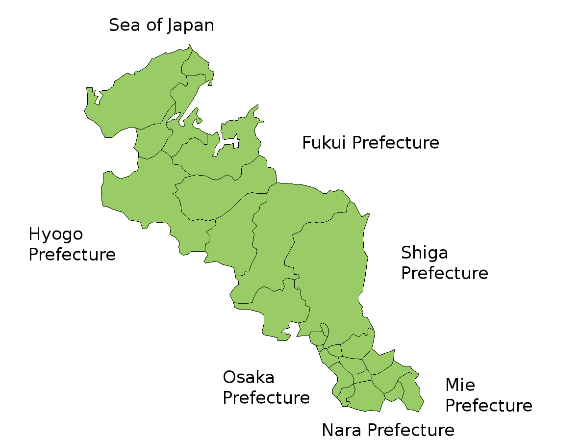
Map of Kyoto Prefecture, Japan. Thanks to Aoki Shigenobu and [1]. Colors from Image:TokyoMapCurrent.png by User:Fg2. |
| Dät | 18 yulul 2006 (original upload date) |
| Fon | No machine-readable source provided. Own work assumed (based on copyright claims). |
| Lautan | No machine-readable author provided. Akanemoto~commonswiki assumed (based on copyright claims). |
Dälastad
| I, the copyright holder of this work, release this work into the public domain. This applies worldwide. In some countries this may not be legally possible; if so: I grant anyone the right to use this work for any purpose, without any conditions, unless such conditions are required by law. |
Jenotem ragiva
Välolös däti/timi ad logön ragivi soäsä äbinon ün tim at.
| Dät/Tim | Magodil | Mafots | Geban | Küpet | |
|---|---|---|---|---|---|
| anuik | 07:22, 2007 yunul 14id | | 1,181 × 901 (42 KB) | Alberth2 | Some towns merged. |
| 11:26, 2006 yulul 18id |  | 1,181 × 901 (42 KB) | Akanemoto~commonswiki | Map of Kyoto Prefecture, Japan. Thanks to Aoki Shigenobu and [http://aoki2.si.gunma-u.ac.jp/map/map.html]. Colors from Image:TokyoMapCurrent.png by User:Fg2. Category:Maps of Kyoto prefecture Category:Maps in English |
Yüms
Pads nonik peyümons ad ragiv at.
Ragivigeb Valöpik
The following other wikis use this file:
- Geb su az.wikipedia.org
- Geb su cs.wikipedia.org
- Geb su eu.wikipedia.org
- Geb su he.wikipedia.org
- Geb su id.wikipedia.org
- Geb su lt.wikipedia.org
- Geb su ms.wikipedia.org
- Geb su no.wikipedia.org
- Geb su pt.wikipedia.org
- Geb su ru.wikipedia.org
- Geb su vi.wikipedia.org