Ragiv:Downtown Rutland, Vermont.jpg
Size of this preview: 800 × 428 pixels. Other resolutions: 320 × 171 pixels • 640 × 342 pixels • 1,215 × 650 pixels.
Ragiv rigik (1,215 × 650 pixel, ragivagret: 87 KB, pated MIME: image/jpeg)
|
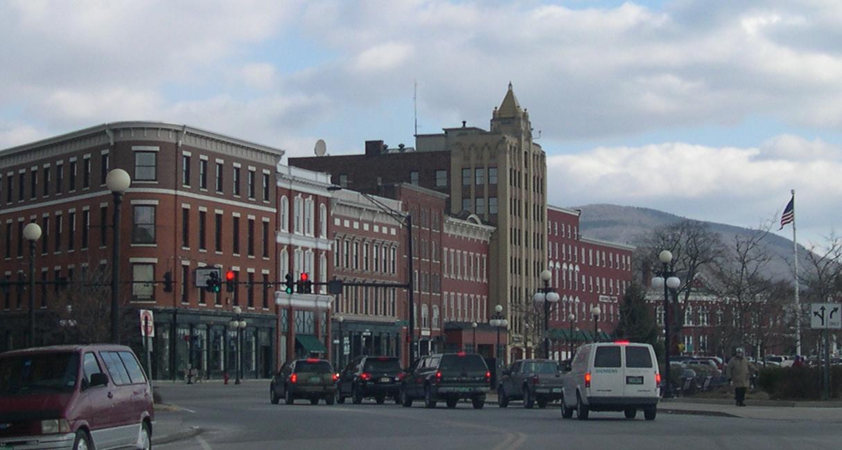
This is an image of a place or building that is listed on the National Register of Historic Places in the United States of America. Its reference number is 80000387. |
Plän brefik
Downtown Historic District, Rutland, Vermont
Dälastad
I, the copyright holder of this work, hereby publish it under the following licenses:

|
Däl pagevon ad kopiedön, seagivön e/u votükön dokümi at ma Dälazöt ad Dokümam Libik: GNU, Fomam: 1.2 u nulikum fa el Free Software Foundation (Stitod: Nünömaprograms libik); nen diläds nevotükovik, nen vödems tegapada balid, e leigo nen vödems tegapada lätik. Kopied dälazöta pekeninon in diläd: Dälazöt ad Dokümam Libik: GNU panemöl. |
| This file is licensed under the Creative Commons Attribution-Share Alike 3.0 Unported license. | ||
| ||
| This licensing tag was added to this file as part of the GFDL licensing update. |
This file is licensed under the Creative Commons Attribution-Share Alike 2.5 Generic, 2.0 Generic and 1.0 Generic license.
- Binol libik:
- to share – to copy, distribute and transmit the work
- to remix – to adapt the work
- Under the following conditions:
- attribution – You must give appropriate credit, provide a link to the license, and indicate if changes were made. You may do so in any reasonable manner, but not in any way that suggests the licensor endorses you or your use.
- share alike – If you remix, transform, or build upon the material, you must distribute your contributions under the same or compatible license as the original.
You may select the license of your choice.
| Object location | | View this and other nearby images on: OpenStreetMap |
|---|
Jenotem ragiva
Välolös däti/timi ad logön ragivi soäsä äbinon ün tim at.
| Dät/Tim | Magodil | Mafots | Geban | Küpet | |
|---|---|---|---|---|---|
| anuik | 02:21, 2006 febul 21id | | 1,215 × 650 (87 KB) | Sfoskett~commonswiki | Downtown Historic District, Rutland, Vermont Category:Vermont Category:Registered Historic Places |
Yüms
Pads sököl payümons ko pad at:
Ragivigeb Valöpik
The following other wikis use this file:
- Geb su an.wikipedia.org
- Geb su ar.wikipedia.org
- Geb su arz.wikipedia.org
- Geb su azb.wikipedia.org
- Geb su bg.wikipedia.org
- Geb su br.wikipedia.org
- Geb su ceb.wikipedia.org
- Geb su ce.wikipedia.org
- Geb su cs.wikipedia.org
- Geb su cy.wikipedia.org
- Geb su dag.wikipedia.org
- Geb su de.wikivoyage.org
- Geb su en.wikipedia.org
- Geb su en.wikivoyage.org
- Geb su es.wikipedia.org
- Geb su eu.wikipedia.org
- Geb su fa.wikipedia.org
- Geb su fi.wikipedia.org
- Geb su fr.wikipedia.org
- Geb su fr.wikivoyage.org
- Geb su ga.wikipedia.org
- Geb su gd.wikipedia.org
- Geb su gu.wikipedia.org
- Geb su he.wikipedia.org
- Geb su he.wikivoyage.org
- Geb su hu.wikipedia.org
- Geb su hy.wikipedia.org
- Geb su id.wikipedia.org
- Geb su it.wikipedia.org
- Geb su ja.wikipedia.org
- Geb su ja.wikivoyage.org
- Geb su kk.wikipedia.org
- Geb su ko.wikipedia.org
- Geb su kw.wikipedia.org
- Geb su lb.wikipedia.org
- Geb su lld.wikipedia.org
- Geb su lt.wikipedia.org
- Geb su nl.wikipedia.org
- Geb su no.wikipedia.org
View more global usage of this file.