Ragiv:Cedar Rapids skyline.jpg
Gretot gudikum no pagebidon.
Cedar_Rapids_skyline.jpg (700 × 241 pixel, ragivagret: 25 KB, pated MIME: image/jpeg)
Plän brefik
| Bepenam |
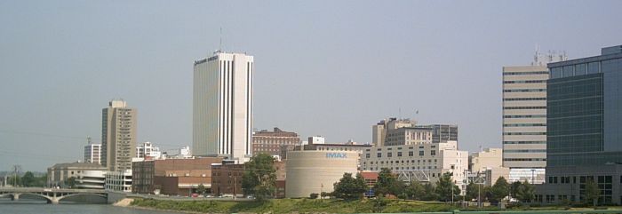
English: Skyline of Cedar Rapids, Iowa, looking northward from the 8th Avenue bridge. Photographed by User:Iowahwyman on June 17, 2007. |
| Dät | |
| Fon | First uploaded to en.wikipedia.org |
| Lautan | Iowahwyman |
| Camera location | | View this and other nearby images on: OpenStreetMap |
|---|
Dälastad
Iowahwyman from en.wikipedia.org, the copyright holder of this work, hereby publishes it under the following license:

|
Däl pagevon ad kopiedön, seagivön e/u votükön dokümi at ma Dälazöt ad Dokümam Libik: GNU, Fomam: 1.2 u nulikum fa el Free Software Foundation (Stitod: Nünömaprograms libik); nen diläds nevotükovik, nen vödems tegapada balid, e leigo nen vödems tegapada lätik. Kopied dälazöta pekeninon in diläd: Dälazöt ad Dokümam Libik: GNU panemöl. |
| This file is licensed under the Creative Commons Attribution-Share Alike 3.0 Unported license. | ||
| Attribution: Iowahwyman | ||
| ||
| This licensing tag was added to this file as part of the GFDL licensing update. |
Original upload log
- 02:48, 21 June 2007 Iowahwyman uploaded "File:Cedar Rapids skyline.jpg" (Skyline of Cedar Rapids, Iowa, looking northward from the 8th Avenue bridge. Photographed by User:Iowahwyman on June 17, 2007.)
Jenotem ragiva
Välolös däti/timi ad logön ragivi soäsä äbinon ün tim at.
| Dät/Tim | Magodil | Mafots | Geban | Küpet | |
|---|---|---|---|---|---|
| anuik | 10:54, 2008 dekul 17id | 700 × 241 (25 KB) | PavelAmLo | {{Information |Description={{ru|1=Седар Рапидс}} |Source=Own work by uploader |Author=PavelAmLo |Date= |Permission=http://upload.wikimedia.org/wikipedia/en/thumb/1/19/Cedar_Rapids_skyline.jpg/250px-Cedar_Rapids_skyline.jpg |o |
Yüms
Pads sököl payümons ko pad at:
Ragivigeb Valöpik
The following other wikis use this file:
- Geb su ar.wikipedia.org
- Geb su arz.wikipedia.org
- Geb su azb.wikipedia.org
- Geb su bg.wikipedia.org
- Geb su br.wikipedia.org
- Geb su ca.wikipedia.org
- Geb su ceb.wikipedia.org
- Geb su ce.wikipedia.org
- Geb su cs.wikipedia.org
- Geb su cy.wikipedia.org
- Geb su dag.wikipedia.org
- Geb su de.wikipedia.org
- Geb su de.wikivoyage.org
- Geb su el.wikipedia.org
- Geb su en.wikipedia.org
- Geb su en.wikivoyage.org
- Geb su es.wikipedia.org
- Geb su eu.wikipedia.org
- Geb su fa.wikipedia.org
- Geb su fi.wikipedia.org
- Geb su fo.wikipedia.org
- Geb su fr.wikipedia.org
- Geb su fy.wikipedia.org
- Geb su ga.wikipedia.org
- Geb su gd.wikipedia.org
- Geb su got.wikipedia.org
- Geb su he.wikivoyage.org
- Geb su ht.wikipedia.org
- Geb su hu.wikipedia.org
- Geb su hy.wikipedia.org
- Geb su it.wikivoyage.org
- Geb su ja.wikipedia.org
- Geb su kw.wikipedia.org
- Geb su ky.wikipedia.org
- Geb su lld.wikipedia.org
- Geb su lt.wikipedia.org
- Geb su mrj.wikipedia.org
View more global usage of this file.