Ragiv:Aerial-GoletaArea.jpg
Size of this preview: 800 × 323 pixels. Other resolutions: 320 × 129 pixels • 1,024 × 413 pixels.
Ragiv rigik (1,024 × 413 pixel, ragivagret: 109 KB, pated MIME: image/jpeg)
Plän brefik
| Bepenam |
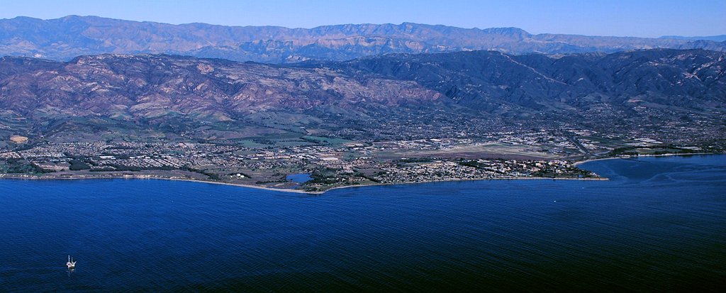
Aerial photo of the Goleta area, Santa Barbara County, California — from offshore.
|
| Dät | 11am |
| Fon | Vobot okik |
| Lautan | John Wiley User:Jw4nvc - Santa Barbara, California |
| Däl (Reusing this file) |
*For full details on Permissions for this user's work, see: User:Jw4nvc/permission/details |
Dälastad
I, the copyright holder of this work, hereby publish it under the following license:
This file is licensed under the Creative Commons Attribution 3.0 Unported license.
- Binol libik:
- to share – to copy, distribute and transmit the work
- to remix – to adapt the work
- Under the following conditions:
- attribution – You must give appropriate credit, provide a link to the license, and indicate if changes were made. You may do so in any reasonable manner, but not in any way that suggests the licensor endorses you or your use.
Jenotem ragiva
Välolös däti/timi ad logön ragivi soäsä äbinon ün tim at.
| Dät/Tim | Magodil | Mafots | Geban | Küpet | |
|---|---|---|---|---|---|
| anuik | 22:19, 2009 yanul 28id | 1,024 × 413 (109 KB) | Jw4nvc | == Summary == {{Information |Description=Aerial photo of Goleta, California area from offshore |Source=self-made |Date=January 12, 2009 11am |Author= MyName (Jw4nvc (<span class="signature-talk">talk</span>)) |other_v |
Yüms
Pads sököl payümons ko pad at:
Ragivigeb Valöpik
The following other wikis use this file:
- Geb su ar.wikipedia.org
- Geb su arz.wikipedia.org
- Geb su azb.wikipedia.org
- Geb su bg.wikipedia.org
- Geb su ceb.wikipedia.org
- Geb su ce.wikipedia.org
- Geb su de.wikivoyage.org
- Geb su en.wikipedia.org
- Geb su es.wikipedia.org
- Geb su eu.wikipedia.org
- Geb su fa.wikipedia.org
- Geb su fr.wikipedia.org
- Geb su ht.wikipedia.org
- Geb su hu.wikipedia.org
- Geb su it.wikipedia.org
- Geb su it.wikivoyage.org
- Geb su ja.wikipedia.org
- Geb su lld.wikipedia.org
- Geb su ml.wikipedia.org
- Geb su mt.wikipedia.org
- Geb su no.wikipedia.org
- Geb su pl.wikipedia.org
- Geb su pt.wikipedia.org
- Geb su sr.wikipedia.org
- Geb su sw.wikipedia.org
- Geb su tr.wikipedia.org
- Geb su tt.wikipedia.org
- Geb su uk.wikipedia.org
- Geb su ur.wikipedia.org
- Geb su www.wikidata.org
- Geb su zh-min-nan.wikipedia.org