Ragiv:Oudeslot.jpg
Gretot gudikum no pagebidon.
Oudeslot.jpg (445 × 336 pixel, ragivagret: 26 KB, pated MIME: image/jpeg)
|
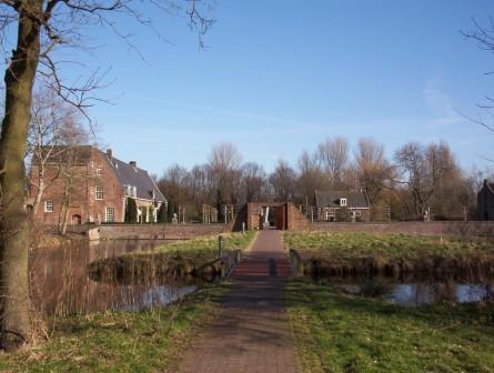
This is an image of rijksmonument number 21120 Information from structured data: |
Plän brefik
| Bepenam |
English: Heemstede park 'Het Oude Slot'. The park is situated at the site of the former castle 'Heerlijkheid Heemstede', or 'Huis te Heemstede', at a strategic position on mouth of the Spaarne river on the Haarlem lake (since 1853 pumped dry and called the Haarlemmermeer polder). Photo from the west side of the moat around the castle site. |
| Dät | |
| Fon | Vobot okik |
| Lautan | Jane023 |
| Object location | | View this and other nearby images on: OpenStreetMap |
|---|
Dälastad
| I, the copyright holder of this work, release this work into the public domain. This applies worldwide. In some countries this may not be legally possible; if so: I grant anyone the right to use this work for any purpose, without any conditions, unless such conditions are required by law. |
Jenotem ragiva
Välolös däti/timi ad logön ragivi soäsä äbinon ün tim at.
| Dät/Tim | Magodil | Mafots | Geban | Küpet | |
|---|---|---|---|---|---|
| anuik | 07:45, 2007 febul 16id | | 445 × 336 (26 KB) | Jane023 | Heemstede park 'Het Oude Slot'. The park is situated at the site of the former castle 'Heerlijkheid Heemstede', or 'Huis te Heemstede', at a strategic position on mouth of the Spaarne river on the Haarlem lake (since 1853 pumped dry and called the Haarlem |
Yüms
Pads sököl payümons ko pad at:
Ragivigeb Valöpik
The following other wikis use this file:
- Geb su br.wikipedia.org
- Geb su en.wikipedia.org
- Geb su fa.wikipedia.org
- Geb su ja.wikipedia.org
- Geb su nds-nl.wikipedia.org
- Geb su nl.wikipedia.org
- Geb su no.wikipedia.org
- Geb su pt.wikipedia.org
- Geb su sl.wikipedia.org
- Geb su www.wikidata.org