Ragiv:Vermilion Ohio aerial view.jpg
Size of this preview: 800 × 533 pixels. Other resolutions: 320 × 213 pixels • 640 × 427 pixels • 1,024 × 683 pixels • 1,500 × 1,000 pixels.
Ragiv rigik (1,500 × 1,000 pixel, ragivagret: 809 KB, pated MIME: image/jpeg)
| Bepenam |
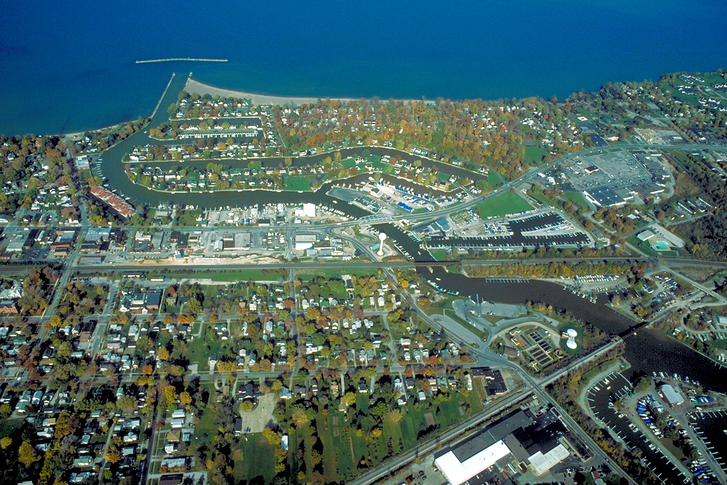
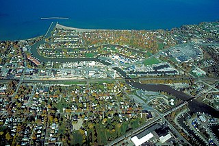
English: Aerial view of Vermilion, Ohio, USA on Lake Erie, near Sandusky, Ohio. The major highway U.S. Route 6 (Liberty Avenue) can be seen running west-east. |
|||
| Dät | ||||
| Fon |
U.S. Army Corps of Engineers Digital Visual Library Image page Image description page Digital Visual Library home page |
|||
| Lautan | Ken Winters, U.S. Army Corps of Engineers | |||
| Däl (Reusing this file) |
|
|||
| Location | Vermilion, Ohio, USA |
| Camera location | | View this and other nearby images on: OpenStreetMap |
|---|
Jenotem ragiva
Välolös däti/timi ad logön ragivi soäsä äbinon ün tim at.
| Dät/Tim | Magodil | Mafots | Geban | Küpet | |
|---|---|---|---|---|---|
| anuik | 22:02, 2007 mäzul 24id | | 1,500 × 1,000 (809 KB) | DanMS | {{Information | Description = {{en|Aerial view of Vermilion, Ohio, USA on Lake Erie, near Sandusky, Ohio. The major highway U.S. Route 6 (Liberty Avenu) can be seen running west-east, then turning to the northeast in the middle of the picture.}} | |
Yüms
Pads sököl payümons ko pad at:
Ragivigeb Valöpik
The following other wikis use this file:
- Geb su ar.wikipedia.org
- Geb su arz.wikipedia.org
- Geb su azb.wikipedia.org
- Geb su ca.wikipedia.org
- Geb su ceb.wikipedia.org
- Geb su ce.wikipedia.org
- Geb su cy.wikipedia.org
- Geb su en.wikipedia.org
- Geb su en.wikivoyage.org
- Geb su es.wikipedia.org
- Geb su eu.wikipedia.org
- Geb su fa.wikipedia.org
- Geb su fr.wikipedia.org
- Geb su ht.wikipedia.org
- Geb su it.wikivoyage.org
- Geb su ky.wikipedia.org
- Geb su lld.wikipedia.org
- Geb su pl.wikipedia.org
- Geb su pt.wikipedia.org
- Geb su simple.wikipedia.org
- Geb su sr.wikipedia.org
- Geb su sv.wikipedia.org
- Geb su tr.wikipedia.org
- Geb su tt.wikipedia.org
- Geb su uk.wikipedia.org
- Geb su vi.wikipedia.org
- Geb su www.wikidata.org
- Geb su zh-min-nan.wikipedia.org