Ragiv:PostSoviet Regions Map.png

Size of this preview: 800 × 547 pixels. Other resolutions: 320 × 219 pixels • 640 × 438 pixels • 1,024 × 701 pixels • 1,356 × 928 pixels.
Ragiv rigik (1,356 × 928 pixel, ragivagret: 63 KB, pated MIME: image/png)
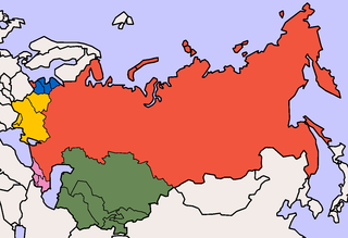
Created by User:Aris Katsaris, based on GFDL maps by User:Morwen. (Including Abkhazia, South Ossetia: File:File-Near Abroad Map.png)

|
Däl pagevon ad kopiedön, seagivön e/u votükön dokümi at ma Dälazöt ad Dokümam Libik: GNU, Fomam: 1.2 u nulikum fa el Free Software Foundation (Stitod: Nünömaprograms libik); nen diläds nevotükovik, nen vödems tegapada balid, e leigo nen vödems tegapada lätik. Kopied dälazöta pekeninon in diläd: Dälazöt ad Dokümam Libik: GNU panemöl. |
| This file is licensed under the Creative Commons Attribution-Share Alike 3.0 Unported license. | ||
| ||
| This licensing tag was added to this file as part of the GFDL licensing update. |
Jenotem ragiva
Välolös däti/timi ad logön ragivi soäsä äbinon ün tim at.
| Dät/Tim | Magodil | Mafots | Geban | Küpet | |
|---|---|---|---|---|---|
| anuik | 07:17, 2015 setul 2id | | 1,356 × 928 (63 KB) | Schwei2 | Reverted to version as of 04:33, 15 September 2009 |
| 06:21, 2015 gustul 12id |  | 1,356 × 928 (40 KB) | AlexTref871 | Crimea | |
| 04:33, 2009 setul 15id |  | 1,356 × 928 (63 KB) | Hoshie | added N. Ireland and a border for the Czech Rep. and Slovakia | |
| 19:23, 2005 prilul 11id |  | 1,356 × 928 (38 KB) | Aris Katsaris | Better, larger, cleaner map, smaller filesize. | |
| 04:32, 2005 prilul 11id |  | 500 × 342 (51 KB) | Aris Katsaris | Created by User:Aris Katsaris, based on GFDL maps by User:Morwen. {{GFDL}} |
Yüms
Pads nonik peyümons ad ragiv at.
Ragivigeb Valöpik
The following other wikis use this file:
- Geb su ar.wikipedia.org
- Geb su ast.wikipedia.org
- Geb su az.wikipedia.org
- Geb su bg.wikipedia.org
- Geb su ca.wikipedia.org
- Geb su ce.wikipedia.org
- Geb su cs.wikipedia.org
- Geb su de.wikipedia.org
- Geb su en.wikipedia.org
- Geb su eo.wikipedia.org
- Geb su es.wikipedia.org
- Geb su et.wikipedia.org
- Geb su fa.wikipedia.org
- Geb su fi.wikipedia.org
- Geb su gl.wikipedia.org
- Geb su hr.wikipedia.org
- Geb su id.wikipedia.org
- Geb su is.wikipedia.org
- Geb su it.wikipedia.org
- Geb su ja.wikipedia.org
- Geb su ka.wikipedia.org
- Geb su kk.wikipedia.org
- Geb su ko.wikipedia.org
- Geb su lv.wikipedia.org
- Geb su ms.wikipedia.org
- Geb su nl.wikipedia.org
- Geb su pl.wikipedia.org
- Geb su pt.wikipedia.org
- Geb su ro.wikipedia.org
- Geb su ru.wikipedia.org
- Geb su sh.wikipedia.org
- Geb su sk.wikipedia.org
- Geb su sr.wikipedia.org
- Geb su tr.wikipedia.org
View more global usage of this file.