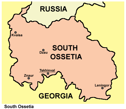
Ragiv:Ossetia05.png
Ossetia05.png (516 × 445 pixel, ragivagret: 22 KB, pated MIME: image/png)
Jenotem ragiva
Välolös däti/timi ad logön ragivi soäsä äbinon ün tim at.
| Dät/Tim | Magodil | Mafots | Geban | Küpet | |
|---|---|---|---|---|---|
| anuik | 06:12, 2012 yunul 17id |  | 516 × 445 (22 KB) | PANONIAN | improved my own work |
| 22:52, 2006 dekul 19id |  | 303 × 243 (7 KB) | Electionworld | {{ew|en|PANONIAN}} South Ossetia map (self made) {{PD-self}} Category:Maps of Georgia |
Yüms
Pads sököl payümons ko pad at:
Ragivigeb Valöpik
The following other wikis use this file:
- Geb su am.wikipedia.org
- Geb su an.wikipedia.org
- Geb su av.wikipedia.org
- Geb su bat-smg.wikipedia.org
- Geb su be-tarask.wikipedia.org
- Geb su bg.wikipedia.org
- Geb su br.wikipedia.org
- Geb su bs.wikipedia.org
- Geb su ca.wikipedia.org
- Geb su ceb.wikipedia.org
- Geb su crh.wikipedia.org
- Geb su da.wikipedia.org
- Geb su eo.wikipedia.org
- Geb su et.wikipedia.org
- Geb su fo.wikipedia.org
- Geb su frp.wikipedia.org
- Geb su fr.wikipedia.org
- Geb su gv.wikipedia.org
- Geb su hi.wikipedia.org
- Geb su hi.wiktionary.org
- Geb su ia.wikipedia.org
- Geb su is.wikipedia.org
- Geb su jv.wikipedia.org
- Geb su ko.wikipedia.org
- Geb su kv.wikipedia.org
- Geb su kw.wikipedia.org
- Geb su li.wikipedia.org
- Geb su mai.wikipedia.org
- Geb su mhr.wikipedia.org
- Geb su mk.wikipedia.org
- Geb su mzn.wikipedia.org
- Geb su nds-nl.wikipedia.org
- Geb su nn.wikipedia.org
- Geb su nov.wikipedia.org
- Geb su pnb.wikipedia.org
- Geb su pt.wikipedia.org
- Geb su ru.wikipedia.org
- Geb su sco.wikipedia.org
- Geb su sq.wikipedia.org
- Geb su sr.wikipedia.org
- Geb su su.wikipedia.org
- Geb su szl.wikipedia.org
- Geb su tg.wikipedia.org
- Geb su tl.wikipedia.org
- Geb su zh-yue.wikipedia.org

