Ragiv:Liévin - Fosse n° 1 - 1 bis - 1 ter des mines de Liévin, puits n° 1 bis (H).JPG

Size of this preview: 450 × 600 pixels. Other resolutions: 180 × 240 pixels • 360 × 480 pixels • 576 × 768 pixels • 768 × 1,024 pixels • 1,536 × 2,048 pixels • 2,736 × 3,648 pixels.
Ragiv rigik (2,736 × 3,648 pixel, ragivagret: 3.31 MB, pated MIME: image/jpeg)
Plän brefik
| Bepenam |
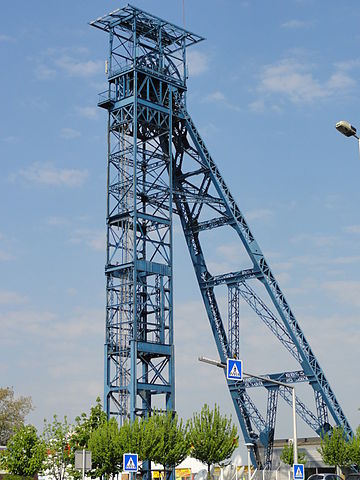
Français : La fosse n° 1 - 1 bis - 1 ter de la Compagnie des mines de Liévin était un charbonnage du bassin minier du Nord-Pas-de-Calais constitué de trois puits situé à Liévin, Pas-de-Calais, Nord-Pas-de-Calais, France.
|
|||||||
| Dät | ||||||||
| Fon | Vobot okik | |||||||
| Lautan | Jérémy Jännick | |||||||
| Däl (Reusing this file) |
| |||||||
| Attribution (required by the license) | Jérémy-Günther-Heinz Jähnick / Liévin - Fosse n° 1 - 1 bis - 1 ter des mines de Liévin, puits n° 1 bis (H) / Wikimedia Commons / | |||||||

.JPG)
| Camera location | | View this and other nearby images on: OpenStreetMap |
|---|
.JPG¶ms=050.422398_N_0002.776358_E_globe:Earth_type:camera__&language=vo)
Jenotem ragiva
Välolös däti/timi ad logön ragivi soäsä äbinon ün tim at.
| Dät/Tim | Magodil | Mafots | Geban | Küpet | |
|---|---|---|---|---|---|
| anuik | 14:47, 2011 prilul 22id | | 2,736 × 3,648 (3.31 MB) | Jérémy-Günther-Heinz Jähnick |
Yüms
Pads sököl payümons ko pad at:
Ragivigeb Valöpik
The following other wikis use this file:
- Geb su ar.wikipedia.org
- Geb su arz.wikipedia.org
- Geb su ast.wikipedia.org
- Geb su ca.wikipedia.org
- Geb su ce.wikipedia.org
- Geb su cs.wikipedia.org
- Geb su diq.wikipedia.org
- Geb su es.wikipedia.org
- Geb su eu.wikipedia.org
- Geb su fr.wikipedia.org
- Geb su fr.wikivoyage.org
- Geb su hu.wikipedia.org
- Geb su ku.wikipedia.org
- Geb su lld.wikipedia.org
- Geb su mzn.wikipedia.org
- Geb su oc.wikipedia.org
- Geb su pcd.wikipedia.org
- Geb su pl.wikipedia.org
- Geb su ro.wikipedia.org
- Geb su sh.wikipedia.org
- Geb su sl.wikipedia.org
- Geb su sr.wikipedia.org
- Geb su sv.wikipedia.org
- Geb su tt.wikipedia.org
- Geb su uk.wikipedia.org
- Geb su vec.wikipedia.org
- Geb su www.wikidata.org
- Geb su zh-min-nan.wikipedia.org
.JPG)