Ragiv:EnglandKent.png
Gretot gudikum no pagebidon.
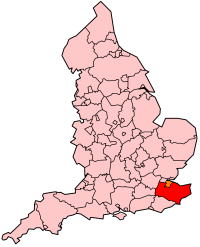
EnglandKent.png (200 × 247 pixel, ragivagret: 22 KB, pated MIME: image/png)

|
File:EnglandKent.svg is a vector version of this file. It should be used in place of this PNG file when not inferior.
File:EnglandKent.png → File:EnglandKent.svg
For more information, see Help:SVG. |
 |

|
Däl pagevon ad kopiedön, seagivön e/u votükön dokümi at ma Dälazöt ad Dokümam Libik: GNU, Fomam: 1.2 u nulikum fa el Free Software Foundation (Stitod: Nünömaprograms libik); nen diläds nevotükovik, nen vödems tegapada balid, e leigo nen vödems tegapada lätik. Kopied dälazöta pekeninon in diläd: Dälazöt ad Dokümam Libik: GNU panemöl. |
| This file is licensed under the Creative Commons Attribution-Share Alike 3.0 Unported license. | ||
| ||
| This licensing tag was added to this file as part of the GFDL licensing update. |
History on English Wikipedia
- (Delete all revisions of this file) (cur) 14:16, 14 June 2004 . . Keith Edkins (Talk | contribs | block) . . 200×247 (22,527 bytes) (Unitary shading)
- (del) (rev) 01:36, 22 January 2004 . . Morwen (Talk | contribs | block) . . 200×247 (26,976 bytes) (map of Kent within England)
Jenotem ragiva
Välolös däti/timi ad logön ragivi soäsä äbinon ün tim at.
| Dät/Tim | Magodil | Mafots | Geban | Küpet | |
|---|---|---|---|---|---|
| anuik | 00:04, 2005 yunul 19id | | 200 × 247 (22 KB) | Airunp | From en:Image:EnglandKent.png map of Kent within England {{GFDL}} Category:Maps of Great Britain es:Kent en:Kent |
Yüms
Pads sököl payümons ko pad at:
Ragivigeb Valöpik
The following other wikis use this file:
- Geb su bs.wikipedia.org
- Geb su cy.wikipedia.org
- Geb su da.wikipedia.org
- Geb su en.wikipedia.org
- User:Morwen/Allcounties
- Category:Schools in Kent
- User talk:KevinCarmody
- User talk:Pickle UK
- Category:Wikipedia requested photographs in Kent
- User talk:Jibbist
- Wikipedia talk:WikiProject Kent/Article Improvement
- User talk:Neddyseagoon/Kent
- User talk:Lynbarn/archive/004
- List of railway stations in Kent
- Category:Wikipedia requested images of Kent history
- Geb su eu.wikipedia.org
- Geb su fr.wikipedia.org
- Geb su fy.wikipedia.org
- Geb su id.wikipedia.org
- Geb su incubator.wikimedia.org
- Geb su is.wikipedia.org
- Geb su ja.wikipedia.org
- Geb su ko.wikipedia.org
- Geb su kw.wikipedia.org
- Geb su la.wikipedia.org
- Geb su lb.wikipedia.org
- Geb su nl.wikipedia.org
- Geb su nn.wikipedia.org
- Geb su no.wikipedia.org
- Geb su qu.wikipedia.org
- Geb su scn.wikipedia.org
- Geb su sk.wikipedia.org
- Geb su sr.wikipedia.org
- Geb su sv.wikipedia.org
- Geb su th.wikipedia.org
- Geb su ug.wikipedia.org
- Geb su zh.wikipedia.org
View more global usage of this file.